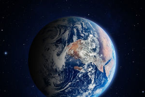
When you look up at the sky, it's easy to forget that satellites orbiting hundreds of kilometers above are quietly observing the Earth, collecting a treasure trove of data.
From monitoring forests to tracking urban growth, remote sensing technology has transformed the way we understand our planet. It's like having a giant set of eyes in the sky, giving scientists, policymakers, and everyday people insights that were once impossible.
Understanding Remote Sensing
Remote sensing is the science of gathering information about the Earth's surface without physical contact. Sensors on satellites, aircraft, or drones capture data across various wavelengths, including visible light, infrared, and radar. This technology allows for detailed mapping and analysis of areas that are difficult or dangerous to access.
Example: A satellite equipped with infrared sensors can detect heat differences in a city, helping urban planners identify areas with excessive heat buildup. This information can guide the planting of trees or the design of reflective building materials to reduce urban heat islands.
Monitoring Environmental Changes
Remote sensing plays a vital role in observing environmental shifts, such as deforestation, desertification, and melting glaciers. By comparing images over time, scientists can measure changes accurately and quickly.
Example: Researchers use satellite imagery to track the shrinking of polar ice caps. By analyzing high-resolution images taken over decades, they can calculate the rate of ice loss and predict its impact on sea levels. This kind of data is crucial for climate change models and disaster preparedness.
Disaster Management and Early Warning
Satellites equipped with remote sensing instruments provide critical information for disaster management. They can detect natural hazards, monitor their development, and help coordinate response efforts.
Example: In the event of a hurricane, satellites track storm formation, wind patterns, and precipitation levels. Emergency services can use this information to issue timely warnings, plan evacuations, and direct resources to affected areas efficiently. This rapid insight often saves lives and reduces property damage.
Supporting Agriculture and Food Security
Farmers and agricultural organizations rely on remote sensing to optimize crop production and manage resources. Sensors provide information about soil moisture, vegetation health, and pest infestations.
Example: A farmer can access satellite data showing areas of a field that are under water stress. With this knowledge, irrigation can be adjusted to improve crop yield while conserving water. Precision agriculture tools powered by remote sensing help produce more food with fewer resources, contributing to global food security.
Urban Planning and Infrastructure Development
Remote sensing is also transforming the way cities are designed and maintained. Planners use satellite imagery to monitor land use, traffic patterns, and population growth.
Example: A city can analyze satellite images to identify regions where new roads or public transit lines are most needed. This reduces congestion, improves accessibility, and supports sustainable urban development. In addition, long-term monitoring helps track the environmental impact of infrastructure projects.
Scientific Research and Exploration
Beyond practical applications, remote sensing expands our understanding of Earth's processes. Scientists study ecosystems, weather patterns, and geological phenomena using continuous, large-scale data.
Example: Ecologists use satellite imagery to map the migration patterns of wildlife. By overlaying satellite data with on-the-ground observations, they can identify critical habitats and design conservation strategies to protect endangered species.
Remote sensing has transformed our perspective of the planet. What was once hidden or difficult to measure is now visible, quantifiable, and actionable. It empowers governments, researchers, and communities to make smarter decisions, from protecting natural resources to planning safer cities. The next time you glance at the sky, remember: countless eyes above are silently shaping a more informed, connected world.